Pictured above: Map of Middleville's village square from the Wallings map of 1863 reproduced by the Lanark County Genealogy Society (LCGS); a copy of which was provided to the Middleville and District Museum.
Township Maps
The Middleville and District Museum holds extensive resources pertaining to the local area. Most of the records pertain to the Townships of Lanark and Darling. There are also some records for the Townships of Dalhousie and Lavant. Check the following maps to see early hamlets, villages, towns and waterways contained in these townships.
Lanark County
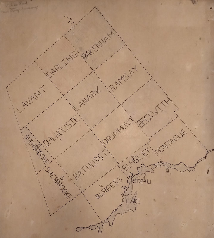
map by Lilas Reid Sweeney
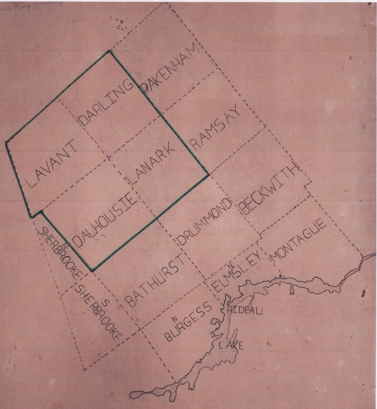
map of Lanark County showing the townships in the primary catchment area of the Middleville and District Museum, as denoted by the green lines (the original map by L. Reid Sweeney)
Lanark Township
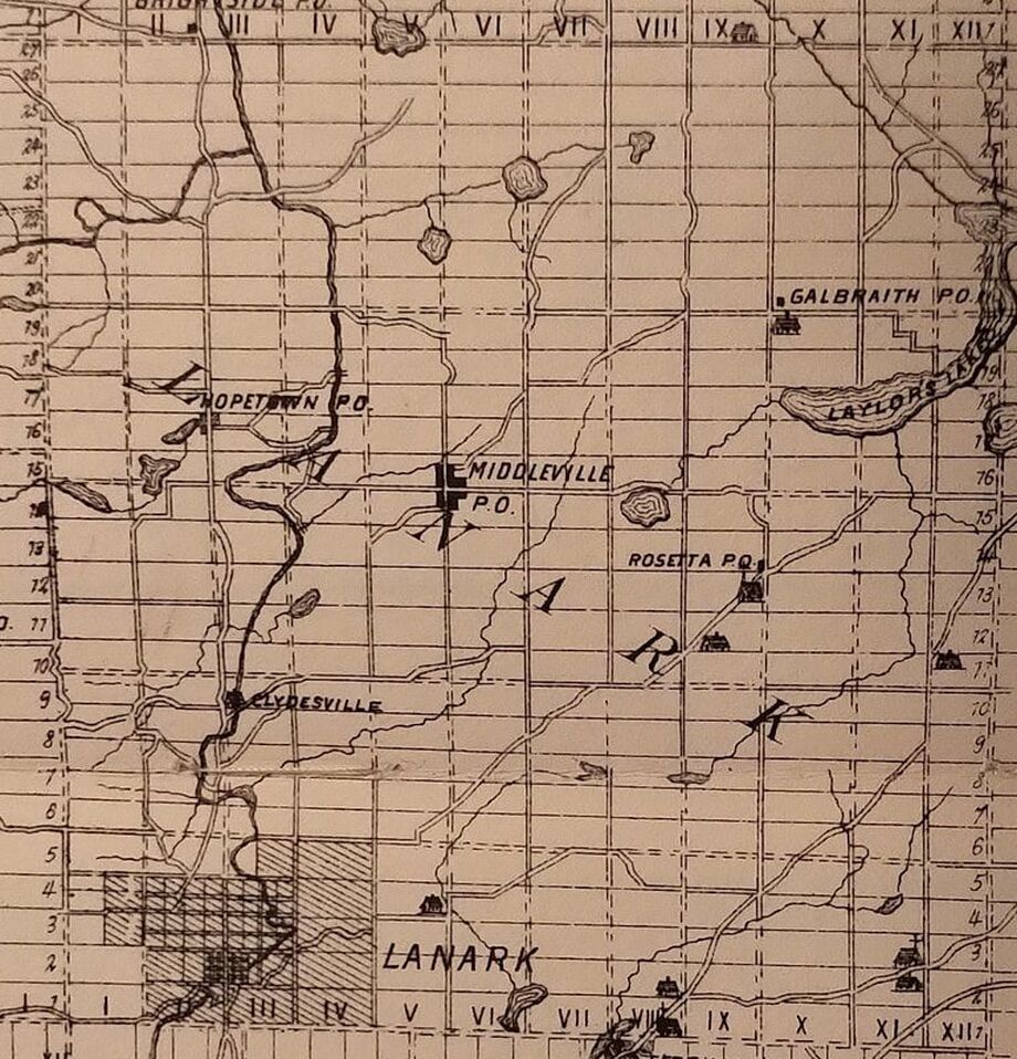
Above from: Historical Atlas of Lanark and Renfrew Counties, Ontario 1880-1881 Illustrated by H. Beldon & Co.
Lanark Township is now part of the municipality of Lanark Highlands. Click on the picture to learn more about the Highlands.
Darling Township
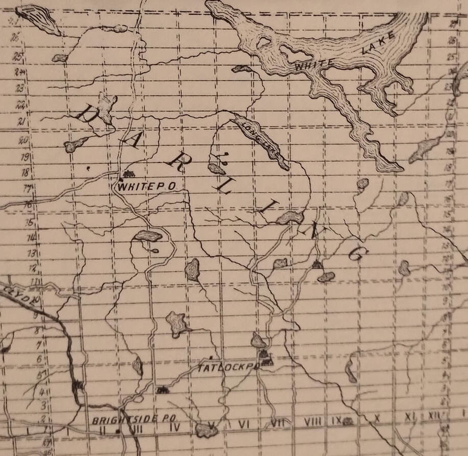
Above from: Historical Atlas of Lanark and Renfrew Counties, Ontario 1880-1881 Illustrated by H. Beldon & Co.
Dalhousie Township
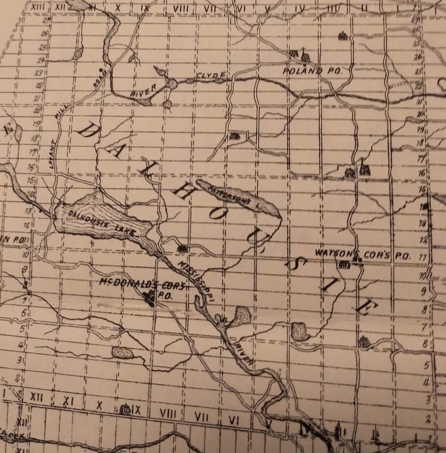
Above from: Historical Atlas of Lanark and Renfrew Counties, Ontario 1880-1881 Illustrated by H. Beldon & Co.
Lavant Township
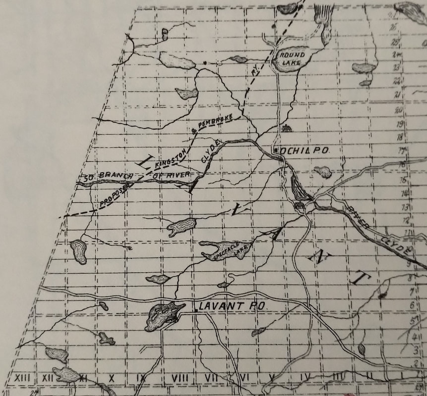
Above from: Historical Atlas of Lanark and Renfrew Counties, Ontario 1880-1881 Illustrated by H. Beldon & Co.